
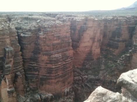
The day we left the Grand Canyon was difficult for a number of reasons. First, it is always challenging to pry oneself away from a place renowned for its incredible beauty and, as we learned from our venerable hosts Geoff and Janice, it is possible to spend entire lifetimes exploring the lesser known, more intimate, tributaries of the canyon and yet only scratch the surface of the wonders the canyon is hiding for only the most diligent of canyoneers. Second, we had to wake up at 4:30 to catch a ride to Desert View with Geoff before he had to be at work at 7. We accepted this ride on account of the weather which by the time we got to Desert View when the sun came out was just above freezing. Bundled up and bracing against the wind we bid Geoff farewell and walked to the edge to take another look at the Canyon as it woke up.

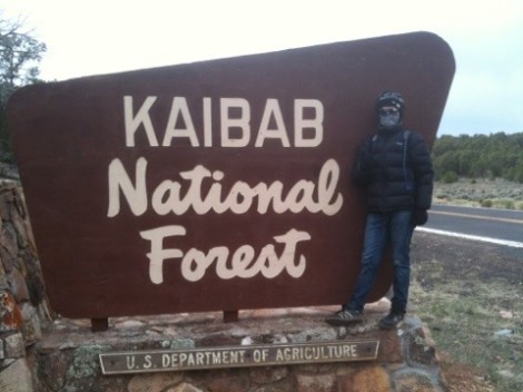
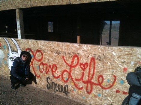
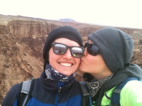
Geared up for a cold downhill ride
Desert View hosts The Watchtower, which is just one of the many buildings in the area designed by architect Mary Colter. Colter was one of the only female architects and designers working in the early 1900s and her thirty year career yielded numerous buildings now considered historical landmarks, including 21 projects for Fred Harvey of Harvey House acclaim. Each of her projects was painstakingly designed to match the rugged nature of its surrounding scenery and culture. The Watchtower stands 70 feet tall, was completed in1932, and thanks to Colter’s diligence, adheres in form and decor (but not size- hers is much bigger) to watchtowers built by ancient Pueblo peoples. This is one of five buildings Colter contributed to at the Grand Canyon.

Mary Colter’s Watchtower at the Grand Canyon
Thankfully, the ride from Desert View to Cameron is all downhill through the Kaibab National Forest. However, speeding downhill wasn’t as sweet because it was freezing and icy needles of wind pricked through our spandex pants and sweaters. The scenery was spectacular though as we whizzed by layered red cliffs and rounded the edge of the Canyon.

We stopped frequently at dilapidated plywood shacks utilized by Navajos selling their wares. There were horse hair pots, dream catchers, knives, and jewelry made from locally obtained gemstones. There were also a series of scenic turnouts that afforded spectacular views of the Little Colorado River.

A puppy friend we made in one of the Navajo stalls

Ever hounded by the weather, we limited our ride to about 30 miles with Cameron as our destination. We stopped at the Trading Post where we enjoyed huge Navajo tacos (beans and the usual toppings on a traditional fry bread the size of a dinner plate) and were thoroughly stuffed after eating only half. We took the leftovers to our beautiful room to enjoy later. Unfortunately for our schedule, but not for our bodies which appreciate the break, we had to hunker down for a day due to the possibility of snow and 50-mile-an-hour gusts.

A sweet Navajo taco with coffee made for a great breakfast

The next day was a doozie. We cycled 71 miles, mostly uphill of course, to Marble Canyon. Nervous about camping on the reservation we decided the only option was to book it to the next viable campground. The only town between Cameron and Marble Canyon is The Gap where we stopped for lunch. A pack of dogs greeted us as we pulled up to the town’s only few structures. We befriended the biggest, but skinniest, dog who followed us and kept us company while we ate and rested. He has a massive broad head that made for a lovely smiling face. We called him Bob. He never begged or hounded us for scraps, but did appreciate when we shared.
Sadly, our GPS was stolen off of Kelly’s bike when we stepped into the store. We had really good luck with keeping hold of our gear until that point but now we are even more cautious. Luckily we have Adventure Cycling maps that show exactly the same info as the GPS and work even better.

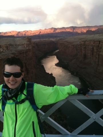
The road between Cameron and Marble Canyon took us by the Vermillion Cliffs, which were gorgeous. On the final leg of the day we crossed over the Navajo Bridge over the Colorado River near Lee’s Ferry. The original bridge which is only accessible to foot and bicycle traffic was erected in 1929 and is one of only a few river crossings around.

Navajo Bridge over the Little Colorado River
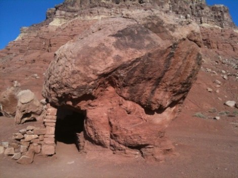
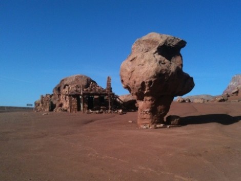
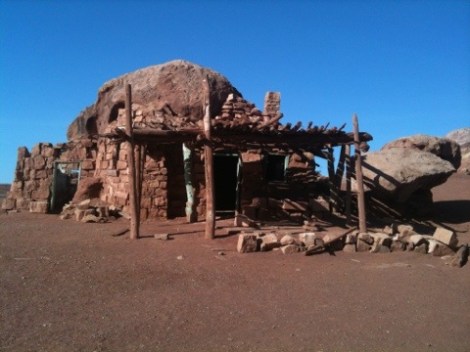
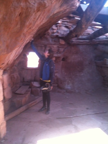
We stayed the night in Marble Canyon and headed out. We stopped 10 miles down the road in Cliff Dwellers for breakfast. This unique location was settled by accident. The Kaibab Pass is so steep and treacherous that early cars without modern fuel injecting technology had to take these passes in reverse to get fuel to the engine. When Blanche Russel’s car broke down in 1929, she was forced to make camp for the night. She liked it so much that she stayed, ultimately building structures on the sides of giant boulders where time and the endless bullets of sand have worn away the undersides creating natural shelter.

Cliff Dwellers Dwelling
Continuing on, the road was fairly treacherous with no shoulder and limited visibility.

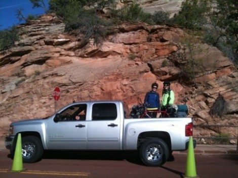
For the umpteenth time this trip, the kindness of strangers presented us with an alternative when Connie and Jim pulled up beside us in their truck and offered to ferry us up to Jacob’s Lake, our next destination. Glad to be spared a day of climbing on rough roads we obliged. As it turned out, the road we would have ridden wound up and up and up around tight corners that were so narrow that two trucks could not pass each other in opposing lanes. We were very glad to skip that hazard. Plus, Jacob’s Lake is at about 8000 foot elevation so we would have climbed roughly 4500 feet in 30 miles.
Jacob’s Lake is close to the North Rim of the Grand Canyon. We had planned to camp up there but we were glad to head right back down instead because of the snow. Plus, the North Rim is closed until May. The ride down was pleasant, tree lined, and fast. The grade was steep and the weight of our bags pulls us downhill at breakneck speed.

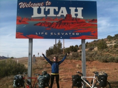
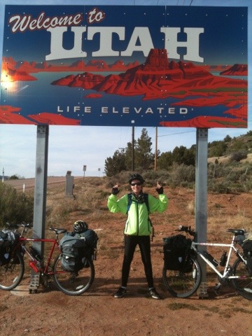
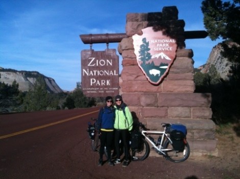
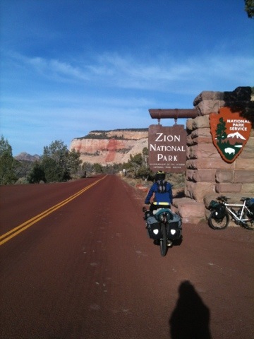
The next town we came to was Fredonia, which was uneventful, except for the gas station advertising its sale of guns, ammo, and beer, so we pressed on. Next came the border into Utah, the third state of our tour. Immediately upon entering the next state the landscape changed. It become greener and the rock cliffs were redder. We cycled through farmland to the campground in Kanab.
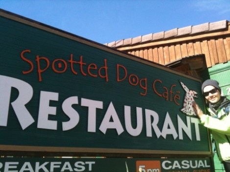
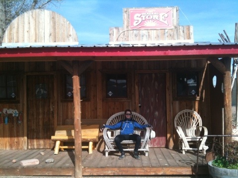
The next morning we set out to explore the town, otherwise known as Little Hollywood because so many westerns were filmed there. We had breakfast at Parry’s Cafe which back in the day was a popular spot frequented by film stars.

Parry’s Cafe

Oh, Pierre, you shouldn’t have come, you’re flirting with danger!
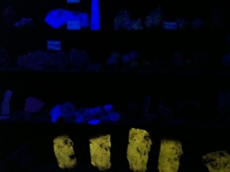
Shortly after breakfast we came across signs for the Moqui Caves where 140 million years of Natural History sparked our interest. This site is not only rich in natural history but in human history as well. The current proprietor, Lex Chamberlain, regaled us with tales of his family history spanning back to his great grandfather who had 55 children with his 6 wives. In 1911, two of his ancestors were part of the all-female city council at a time when women in office were unheard of; women were not even allowed to vote yet. His parents were also notable figures, as they made a number of geological, archeological and paleontological discoveries in the area including dinosaur tracks, Native American artifacts and luminescent minerals. His father, a jack of all trades, was an award winning wood carver, sculptor whose bronzes were prized by President Reagan, and rock hound who built a gem-surfaced bar and dance hall at the Moqui Cave.

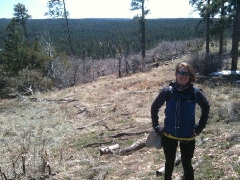
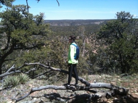
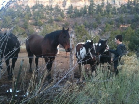
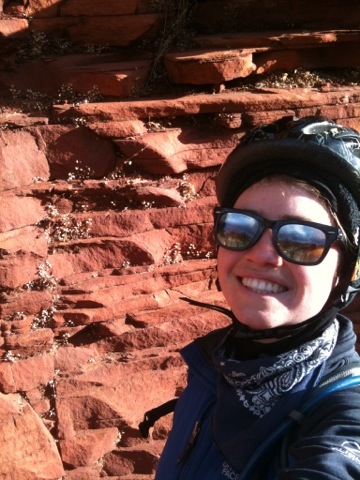
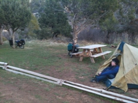
The day’s ride was hard and uphill. We are beginning to feel like Sisyphus, rolling uphill then down only to go back up again. With our next national park so close we were devastated to have taken a wrong turn that took us 8 miles out of our way toward Orderville instead of Zion. The road smelled like livestock and we counted four deer carcasses by the roadside in a span of ten miles. The depressing ride was livened by a herd of buffalo, however scrawny and destined for someone’s dinner as they were. Our campsite for the evening was just outside the Park entrance and shared by a paddock of painted horses.
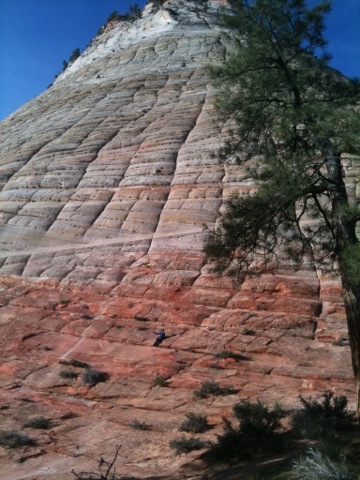
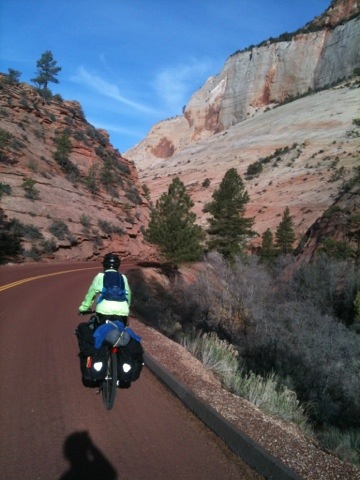
Today’s ride put the love of riding back into us. We cycled on the red asphalt road passed the park entry gates (after paying the absurd $12 per bike) and downhill (yay!) through the stunning canyon. The striated rock striped white, red and orange slackened our jaws and loosened our voices into triumphant yells. This is what we’re talking about!
There are two tunnels on the eastern side of the park, one of which is a mile long so bikes are not allowed. The park ranger at the entrance told us we’d have to find a ride through it and that sometimes the wait for a truck can be long. Our luck so far has been remarkable though and there was a truck waiting to enter the tunnel right as we pulled up.
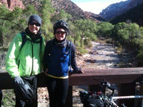
The day’s ride into Springdale at the southern edge of the park was short and pleasant.
Here we hit up a breakfast place, then a bike shop where we stayed for about two hours getting tuned up and deliberating over the best choice for Mi’s new seat, had some Thai food at a place completely taken over by fuzzy caterpillars (nosey ones that climbed over us as we ate and hitchhiked on our bikes), and finally made it to the campground where we are now relaxing.
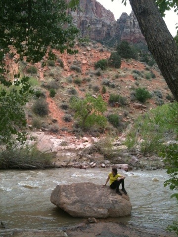
The river is right behind us and we are surrounded by towering cliffs. Quite scenic indeed. We plan to take a rest day here to explore and hike before we head off again.

Love to all our readers, especially those generous folks who have donated to Action Against Hunger! Thanks Stephen and Gerd from Norway!

That really sucks about your GPS. Isn’t Zion great. I love UT.
That was Geoff
What no picture of Bob? I look forward to reading about what you are seeing and experiencing!
Love you!