
According to the Adventure Cycling maps we have been using, the most challenging section of Utah is between Hanksville and Blanding. This 130 mile stretch through deserts, canyons, mesas, and buttes had only one dinky store and two water sources, both off route. When exerting so much energy it is important to stay hydrated and drink at least a gallon of water a day. At full capacity we carried 7.25 liters which isn’t even a gallon each so in Hanksville we both bought an extra liter of water so we could carry in total 9.25 liters.
We also went to the only grocery store in Hanksville which had moldy bread, wilting vegetables, and canned fruit soaked in high fructose corn syrup. We bought what we could and hoped the next grocery store would provide more options. Luckily a nice couple saw us making breakfast at the picnic area in front of the store and shared some of their oranges with us.
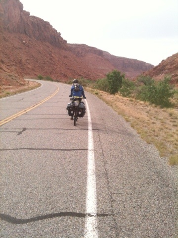
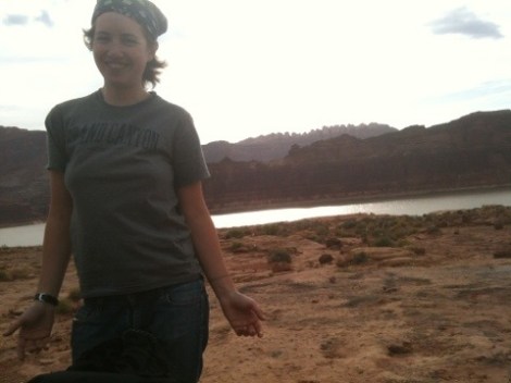
At about 11:30, we began our journey from Hanksville through a hot desert landscape on Highway 95 and instantly hit a headwind of 15-20mph. The headwind progressively became more severe, kicking dust and sand up into whirlwinds that dominated the road. Any exposed skin was battered by fine stinging sand.
The wind didn’t let up much as the day wore on so when it was time to find a place to set up camp, we needed to find some protection from the onslaught. We had been traveling through open range since Capitol Reef so we also needed to take the wandering cows into consideration. The range was mostly treeless, dotted with sparse shrubs, so taking refuge under a tree or beside a pile of boulders was out of the question. Fortunately, before too long Kelly found a tunnel under the road that fit our needs.

Thankful to be out of the wind, we set up our tent, positioned our bikes at the entrance of the tunnel just in case the cows had the same idea, and settled in for the night.
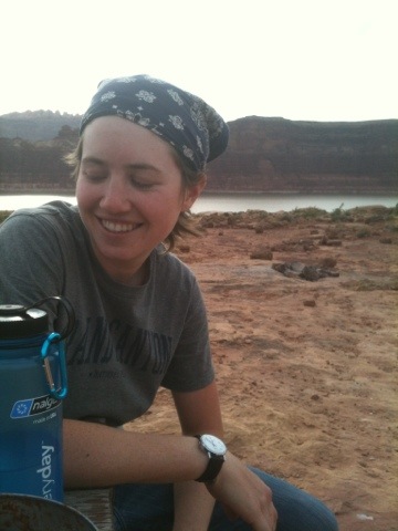
As the sun went down a series of squeaks echoed through our humble abode. We waited in the darkening tunnel for a while wondering about the source of the noise.

Then we saw them: bats fluttering at the tunnel’s entrance, obviously agitated by our intrusion. They wheeled and soared over our tent for about half an hour before disappearing back into the night. Once things quieted down we closed our eyes and tried to rest, but we were interrupted once again by a rustling near our bikes. It would stop whenever we moved or shone a light in the direction of the noise but start up again as soon as we were quiet. This went on all night. We never did find out what was trying to get at our food, but we did yawn through our next day of riding as a result.

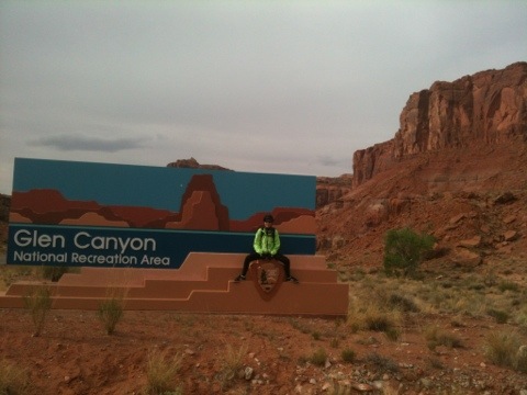
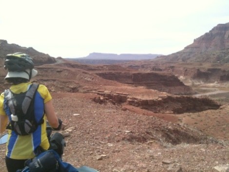
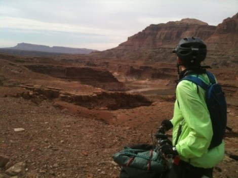
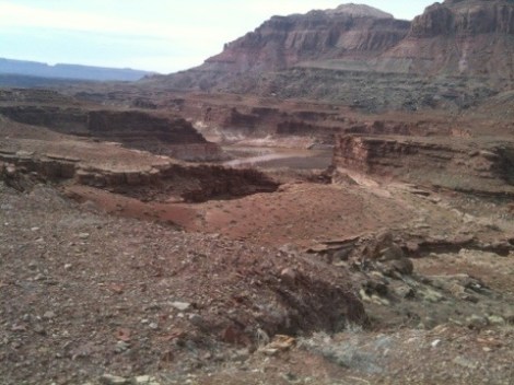
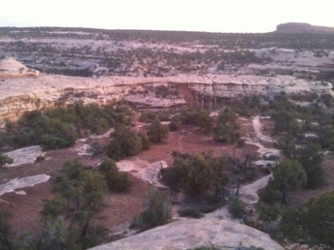
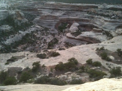
Although we were tired, and the wind was just as bad as the day before, it was necessary to get to our next destination 40 miles away to fill up on water. Once we passed the summit, we entered Glen Canyon.
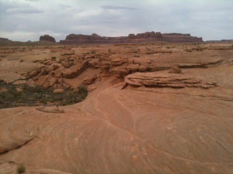
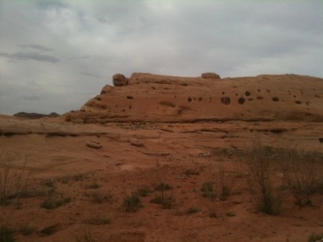
A staggering beauty all around; it was like cycling through a chocolate bar- a Flake in places with thin rock layers piled high, an Aero where the sandstone was pitted with holes, and fudge where solid rock walls were polished to a shine.
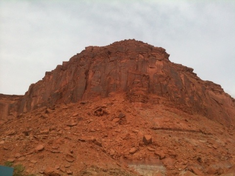
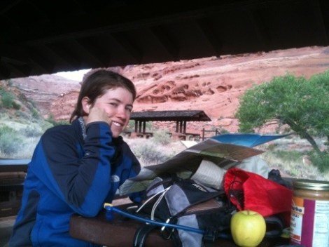
We took our time gliding down into the canyon and stopped frequently in awe. We took a break early at a rest stop at Hog Creek where we enjoyed the last of our fresh fruit.
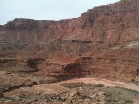
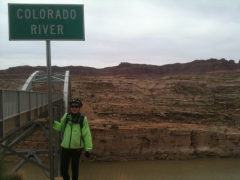
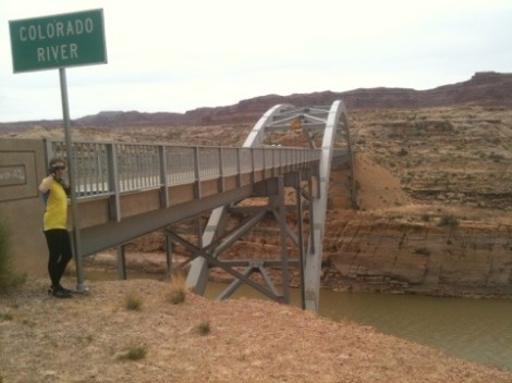
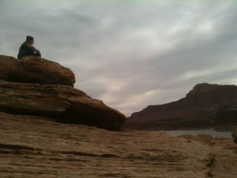
Soon it was uphill again and before long we saw our first glimpse of Lake Powell and the surrounding rivers and creeks that flow into it.
We crossed the bridge over the Colorado River and made it the few miles into Hite National Recreation Center where we set up camp near the lake and filled up our water.
The grocery store at the recreation center was even worse than in Hanksville, providing no fresh food. We bought overpriced white bread and cookies and decided we would tough it out for the next 80 miles with energy bars, dried fruit, rice, and beans. It would not be as well-rounded of a diet as we are used to but could certainly get us to Blanding.

When we returned from bathing in the sink, a Canadian couple who were also cycling tourists rolled into camp. Heading the same direction we relayed the woes of the wind and the hardships of the hills. They started in Las Vegas and were going to complete a large circuit around Utah hitting up all the national parks they could. Upon sharing our route they shared much needed information and tips about cycling in Canada. We will surely contact them when we are in their neck of the woods!


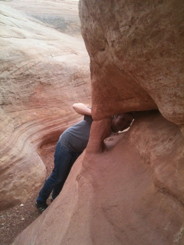
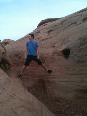
We then explored around the lake, climbing rocks, entering slit canyons, and eventually made it to the beach of the lake.


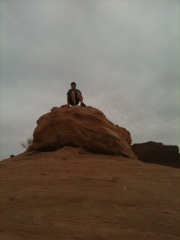
We meandered for a long time before finding the perfect rock to catch each other up on the solitary thoughts of our cycling minds.

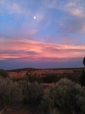
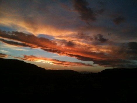
We wandered back to the tent just in time to watch the sunset from our sleeping bags, then drifted into sleep.
The next morning Mi felt feverish amoung other symptoms, but because we didn’t have enough food to take the day off, we pressed on. Luckily the Canadian tourists knew of a water source 40 miles up the road, then 5 miles off route at the Natural Bridges National Monument. We decided we would take it slow and stop there for the night.
11 hours later, we finally made it to the visitor center to learn the camp ground was full.
As we filled our water and discussed our options, a woman named Sally came over and let us know of many BLM areas that were excellent camp spots but at least 5 miles away. She then went back inside and as we were gearing up to ride away she rushed back to tell us we could set up our tent on her and her partner Chris’s campsite as they had not reached the maximum number of tents on one site.

We gratefully accepted and met Chris and Sally at spot 6 where they shared their space, love, and beer.
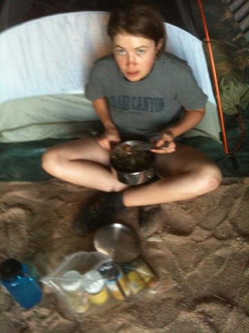
Sally and Chris owned an outdoors store in Wichita, KS for 34 years before they sold it and now spend their time exploring the country with all of the top of the line gear they have collected over the years. These wonderful women taught us how to use our stove more efficiently which was a great load of frustration lifted off our backs. Sally took us on the 9 mile loop to see the natural bridges that evening and shared her extensive knowledge of the park an surrounding areas.
Natural rock bridges differ from arches in that they are created by water rather than wind.
The national monument is home to three bridges: Sipapu is 220 feet tall and 268 feet wide, Kachina is 210 feet tall and 44 feet wide, and Owachomo is 106 feet tall and 27 feet wide. Owachomo is the oldest and most fragile of the three. At only 9 inches thick, it is in danger of collapse, especially due to what may turn out to be a fatal crack, so if you are interested in witnessing these marvels, you had better do it soon. Sipapu is the second largest such bridge in the world (the largest is Rainbow Bridge in Glen Canyon).
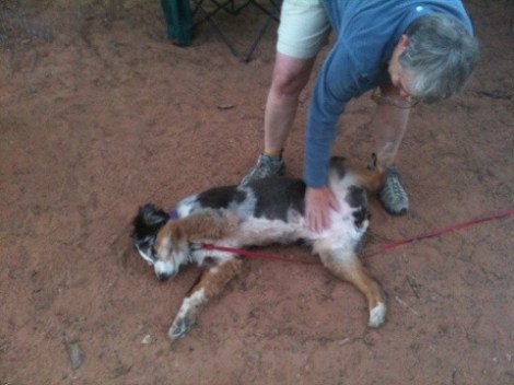
The next day we went to Blanding with Sally and Chris (and their ten year old Australian Shepherd, Polly) to buy proper food for that evening and for the next day’s ride.
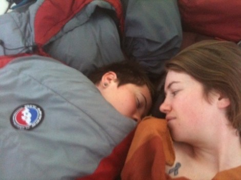
Milo was not ready to wake up so early on a day off from cycling.

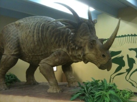
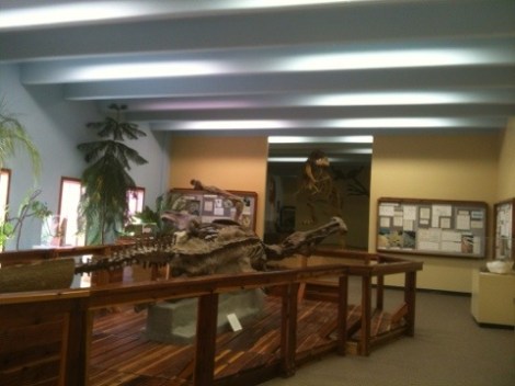
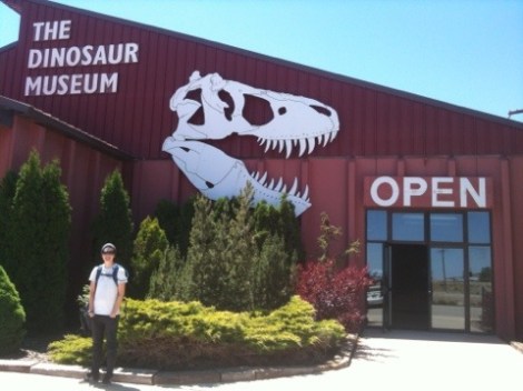
While Sally and Chris went to the Edge of the Cedars archeological museum we went to the Lost World Dinosaur Museum where Mi excitedly explained what each exhibit was and how it differed from the last to the less knowledgable (as far as dinosaurs go) Kelly. The museum is not a bad size and features information about dinosaur evolution, physiology, and pop culture.
We got back to camp about 4pm where we promptly made dinner, then turned in early to ensure a decent amount of sleep before the birds would wake us before dawn.
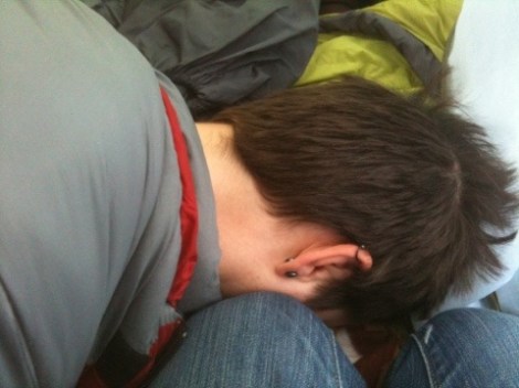
Kelly rarely has trouble waking up in the morning, a problem for Milo.
We woke up at 5:30, broke down camp, made breakfast, then began the last 40 miles of Highway 95. We stopped for a few snack breaks but were determined to get to town before lunch. We rolled into town at 1:30 and spent the remainder of the afternoon at the laundry mat where made our crunchy clothes soft again. We are now at the campground, with clean bodies and bellies full of fajita style burritos.
Tomorrow we were supposed to cross into Colorado but decided that we love Utah so much that it would be tragic to leave without seeing Moab and the Arches. So instead we will cross into Colorado shortly after Moab and explore the northwest corner of Colorado to save time and avoid the 13,000 foot peaks which our map tells us are especially challenging.
Now it is late and in order to get the majority of our ride in during the morning and get to the grocery store in Monticello before it closes we must close our eyes and drift into a sleepy slumber. Goodnight!
As always, thanks to all of our dedicated readers, especially those who have donated to Action Against Hunger and/or our travel fund. Occasionally a few generous souls we have met on the road have contributed to our quest by handing us cash so we can take action against our own hunger. Thank you!

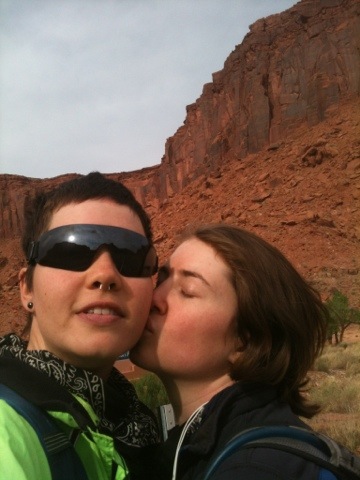
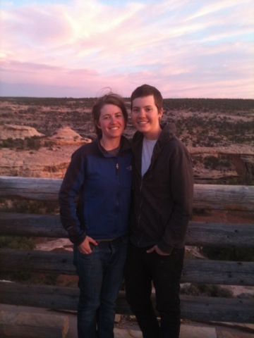
Absolutely incredible women.