Before this trip we had long heard the name Moab thrown around. We didn’t know exactly what Moab had to offer but knew it was somewhere worth visiting, so we went off our mapped Adventure Cycling route to make that happen.
At the campground in Blanding, we met a fellow cyclist, Caitlin, 3 days into her first tour heading the opposite way. We shared information, stories, and cookies with our new friend while the sun went down. The campground was nothing special and as always we went to bed early, sleeping soundly despite being surrounded by RVs.
Moab is 75 miles north of Blanding, with very little in between (in the way of services) but we ventured into the unknown anyway to understand the hype firsthand. We left Blanding early Monday after taking a rest day at the campground there, where everything is closed on Sundays due to the largely Mormon population.
We woke early, said goodbye and good luck to Caitlin, and headed north.
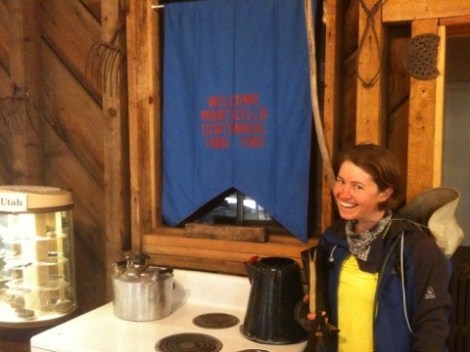
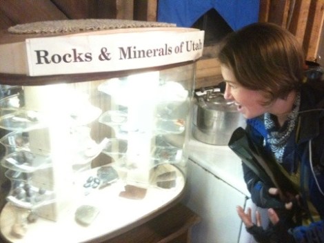
We quickly made it to Monticello, the town where the Adventure Cycling map suggested we cross into Colorado. We stopped at this information center with a small local history museum. This is where we bought our Utah Rocks shirt, which will most likely become a “top of the drawer” shirt.
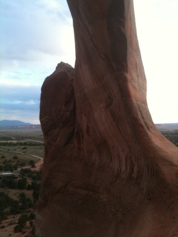
The topography was unknown to us because we deviated from our maps but after 6 weeks and many peaks behind us, we were not concerned. The ride, like much of Utah, was beautiful.
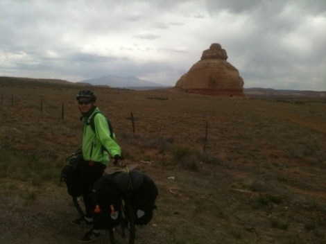
50 miles later we set up camp overlooking Wilson’s Arch.
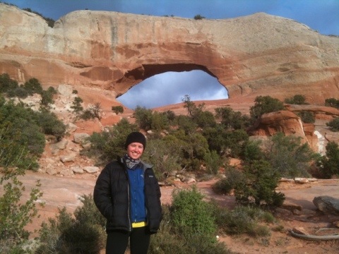


The arch is a beautiful piece of art created by mother natures’ forces (arches are made by wind and sand whereas bridges are made by water).

We ate dinner and watched the sunset before turning in at about 8:30.

The next morning we cycled a harrowing 25 miles on the 191N where there was no shoulder, road work, and a constant flow of semi trucks thundering by before making it into Moab at 10am. For being such a bicycle friendly town, it was not so easy to access via leg power. Our original plan was to stay at the Lazy Lizard international hostel but we were deterred by the filth and the overwhelming smell of feet. We have aptly renamed it the ‘Leprosy Lizard.’
After being deterred by the Leprosy Lizard, we ventured further, becoming increasingly agitated due to hunger, too many industrial wastelands, and traffic. We had both been looking forward to a break from camping and an opportunity to rub elbows with fellow travelers, not to mention a cheap room, at the hostel so we were disappointed by the shoddy digs.
After riding for a while down a busy road, we spotted the Moab Micro-brewery, which we had been looking forward to since we heard of its existence. Auspiciously, there was a bike shop right next door.

We rolled our tattered and tired bikes into the Chili Pepper bike shop for a tune up. After a quick diagnosis, Kelly learned her back wheel had multiple broken spokes. The mechanics determined it would be cheaper to replace the wheel rather than rebuild it. The problem is that they did not stock the necessary wheel so they had to order one and it would not arrive until the next afternoon. We had planned to stay a couple nights so we agreed to the repairs, then hit up the brewery.
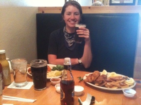
Apparently in the state of Utah, one person can only have two drinks in front of them at a time, which crushed our hopes of having a sample platter of all 11 microbrews. We each tried 2, then settled for the Derrailuer dark Amber and the Raven Stout brews. We enjoyed lunch and with a bit of a buzz headed to the campground.
Everyone in town recommended “Up The Creek” campground, which we found was the coolest campground we have been to in a long time. There were no cars or RVs allowed in the campground so we were not breathing in smog or putting up with noisy engines.
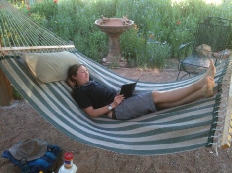
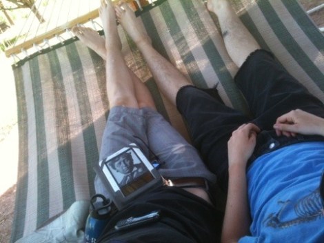
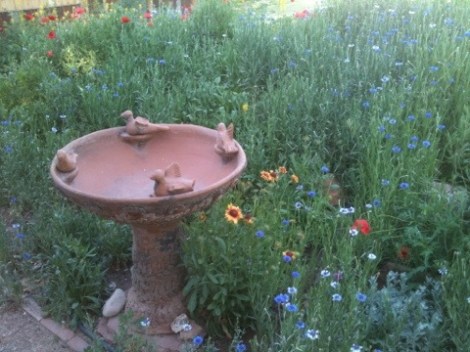
The campground lines a creek that flows into the Colorado River and a bike path that takes you anywhere in town you would like to go. After setting up camp and exploring a bit we returned to the campground and enjoyed the afternoon reading on a hammock in the garden where bees on the array of flowers all around.
About dinner time we headed back to our tent and noticed a couple other bike toursits. We quickly made friends, exchanged stories, looked at maps, and compared bikes. Everyone in the campground had a bike, and as we made dinner many fellow campers came by to say hi to ask us where we were from and where we were going.
It was refreshing to be in a town where everyone is active, whether they enjoy mountain biking, rock climbing, and/or river rafting. Even at the local schools the bike racks were overflowing. When we cycled around to check out the town, we noticed more than just physical activity as an interest. There were comminity gardens, a cultural center, an aquatic center, and more.
The next day, we slept in to 7:30, lazily made breakfast, then headed to the library to map our route to Rawlins, WY. During breakfast we decided to stay an extra night at the campground so we would not have to stress about time and have one last shower before the next 6 day stretch of camping on BLM land. Afterwards, we took our bikes to the shop, then headed back to the brewery while we waited.
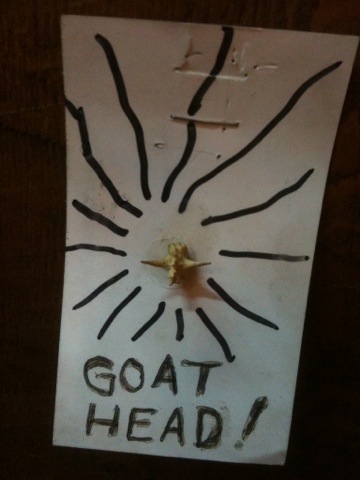
In the bike shop they displayed the bane of all cyclists existence: The Goat Head! We have talked about these evil thick-horned thorns before, which easily puncture bicycle tubes.
Afterwards, about 5pm when our bikes were fixed, we went food shopping for the next 6 days of riding. We made dinner, took a shower, and turned in early before our 95 mile stretch between civilizations.
The next morning we packed and made breakfast among a bustling crowd of other cyclists doing the same. Usually when we stay at a formal campground we must remain quiet so as not to disturb the other campers but most everyone at Up the Creek was up with the sun like us. We aimed to make 50 miles on a pretty desolate stretch so we loaded up with supplies, filled our water bottles to capacity, and headed out on HWY 128.
The maps we had printed at the library showed a large hill at the beginning of the day, a big spike on the topographical profile, so we were psyched out all morning. As it turned out, the hill was totally manageable and we dominated it before our first snack break. The first 20 miles of our route were bordered on one side by sheer towering rock walls and on the other by the Colorado River. It was beautiful and the proximity of the river kept the temperature mild. We couldn’t resist and found a beach on the river, set our bikes down on the side of the road, and took a quick dip before continuing on our way.
Once we veered away from the river the weather warmed up, so out came the shorts, the sun hats, and the cooling bandanas. Staying properly hydrated is key when exercising, especially as the heat starts to build, so as soon as our stores of water started to get low we laid our bikes by the side of the road and looked thirsty. Every single car stopped to make sure we were ok and each driver shared what they had. Before long we were back up to capacity and could continue on our way without fear of running out or hurting our bodies by rationing meager stores.
The next point of interest on our journey was the town of Cisco. It is now a dilapidated ghost town made up of skeletal buildings and chain link fences. There is no indication as to what happened there and not a soul around to ask- the place is populated by ferrets and prairie dogs now.
A few miles later, near the intersection of the I-70 we stopped for the evening and set up camp. Though close to the I-70, not one car went on the road we slept on, making for a quiet night. The day had become progressively warmer so by 6pm we did not want anything warm for dinner. We ate cold beans, nuts, dried fruit, peanut butter, Clif bars, and chocolate. As always, we watched the sunset, this time with the addition of antelope frolicking about and prairie dogs running from burrow to burrow, but we were still asleep before the sun shared its last glimmer of light.

We woke up and emerged from our tents to find that some antelope had camped just a few hundred feet from us and were also getting ready for their day. They stared at us for some time before hopping off across the tawny dunes.
We began today’s ride with a 12 mile stretch on the I-70, while the traffic was light and the weather was mild. It wasn’t as scary as we had imagined it because there is plenty of space and truckers are taught to move to the left, even when passing a cyclist. As the morning progressed and more RVs and cars went by, we wished that they were taught how to pass slower moving traffic like truckers are. They unknowingly spit dust up in our faces, and their momentum displaces the air so much that it sets us off balance.
As the morning traffic picked up, we exited the interstate and continued on Old Highway 6, which in places resembled Route 66 Million Potholes. 6 miles later, we crossed the Colorado border and the road was once again paved.

The states’ borders we have already crossed have been marked by big signs that were colorfully announcing our arrival and welcoming us into the state.
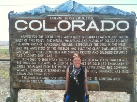
On this seldom used road, however, the pillar that once said Colorado one side and Utah on the other was so riddled with bullet holes that it was nearly illegible. Our only clue that we had indeed passed into Colorado was the change of quality in the road.
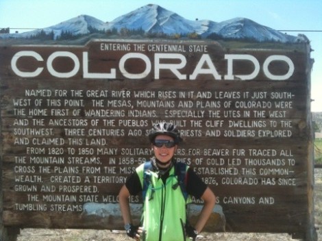
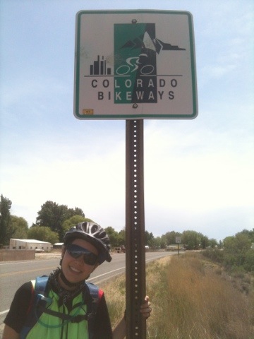
The first signs that we saw and were able to photograph were near our day’s destination, Loma.
As soon as we came to the intersection where we were originally going to turn to head north, a man in a truck stopped and started asking the usual questions. He shared that he cycles all the time, including 6 months out of the year in Ecuador. He only returned the week prior and was on his way to meet a friend for lunch. He offered to meet us in Fruita 6 miles farther east, then shuttle us to his house for a shower, laundry, and a bed to sleep in. We took him up on the offer and then split ways for a few hours.
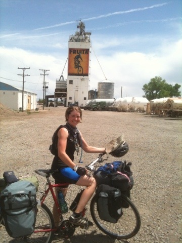
We rode into Fruita and discovered it to be just as bicycle friendly as Moab. With bicycle accommodations and shops at every turn, we felt at home. We ate downtown and enjoyed a microbrew before our new friend, Kim, met up with us. He took us to his diggs and we started shooting the breeze. He informed us that Colorado has a 3 ft mandatory passing rule, that cyclists are legally allowed the entire lane, and do not have to ride single file. Of course, we will do what is safest, but we still wish every driver around the country respected cyclists’ lives as the people of CO are mandated to do.

At this point our route up north to Wyoming is largely unplanned due to some last minute changes so part of tomorrow’s ride will be to the nearest library. We recently learned from our contact in China that due to the restrictions of our visas we cannot arrive until mid or late August. We had originally planned to fly to China on August 1st but now we have a few extra weeks to play with. This will give us more freedom to explore and not feel so rushed.
Before signing off, we want to thank all of the donors to our Action Against Hunger page, but have still not reached our second goal of $1000. Even a $10-20 donation can mean life and death to a child, and the claim to activist fame in our blog to any donor. Please help us help them!
Click on the icon below to add your life-saving contribution!
![]()
Goodnight.
